
Conclusion: References
Movies. — Internet Resources. — Paper Maps. — Internet Maps. — Books for Travelers. — Books on the Taliban. — Books on Islam.
Movies
The Beast of War (or The Beast), director Kevin Reynolds, 111 minutes, 1988 (IMDB)
The only good movie on the war in Afghanistan, and also a great movie by itself. A Russian tank is lost in a desert, and a group of Afghans hunt it with a broken grenade launcher. One has to wonder why the actors have never again acted like this in subsequent movies. They obviously could, as this movie shows, but they never did. Dzundza got fat and became a supporting actor. Stephen Baldwin has had some good star roles since that, but he has been typecast as a comedy actor. And I have never seen Jason Patric again. Pitiful.
Internet Resources
If you search for internet pages with the word afghan in their addresses, you will get about a million results. Most of them are totally useless. The very few good sites I have seen are listed below.
http://www.flyariana.com — a site of Ariana with flight schedules, prices, Afghan consulates, and tons of errors and typos.
http://www.kamair.com — a site of KamAir, an Afghan air carrier that flies to Dubai and services many local routes. Its designers have managed to get hopelessly lost in just ten web-pages. Still, one can find useful information on prices and schedules here, as well as the contact info.
http://www.talesofasia.com/afghanistan.htm — a great site with the stories of its author's travels, including Afghanistan and Pakistan in 2003.
http://www.zharov.com/photos/afghanistan01.html — some of my photos of Afghanistan.
Paper Maps
You only need one map of a country, and the mentioned below Nelle's is enough. Moreover, you can go without any country maps whatsoever since it is unlikely that you will go to some obscure places in addition to the main cities. Therefore, it is enough to have a small, A4-size, map of the country to get a general idea on Afghanistan's geography. Various bigger-than-a-city maps have no practical value and are listed here as a souvenir only, as a nice-looking object you can put on a wall and look at after you come home.
Afghanistan — Nelle's Maps, 2001. — ISBN 3886186652. (Amazon)
The best and the easiest to buy map of Afghanistan. 15 km in 1 cm. Unfortunately, the country is divided into two halves, one half on each side, and one has to turn the map around all the time. There is a useful map of Kabul's center. Recommended.
Tactical Pilotage Chart — Defense Mapping Agency, 1992.
American military maps, 5 km in 1 cm. Afghanistan is covered by the sheets 67-1055-G07A, -G06A, -G06B, -G06C, -G06D, -H07B, -H08A. A highly complicated product with clearly visible viciousness of a military mind. Not practical for a tourist trip and should not be brought on one. But a good souvenir, can be used as wallpaper.
Joint Operations Graphic — Defense Mapping Agency, 1992.
Even more detailed set from the same company, 2.5 km in 1 cm. The sample sheet here is not Afghanistan but Iraq, but you can get the idea although it is not the best scan.
Topographical maps of Afghanistan, 1:50,000 — Soviet General Staff, 1985–1991.
These combat maps are still secret in Russia, but you can get them online.
Topographical maps of Afghanistan, 1:200,000 — Soviet General Staff, 1985–1991.
It is 2 km in 1 cm, 123 sheets.
Internet Maps
There are both many and few maps of Afghanistan in the internet. “Many” because there are many of them. “Few” because they are mostly useless. There is only one set of pre-war paper maps of five major cities, and a couple of digital sets have been made based on that one. Kabul has more variety, but it is mostly schematic products, there are no truly detailed maps. And non-major cities have not been mapped at all. Balkh, Ghazni, Lashkargah — forget about it.
But during the “war on terror” the media have cooked up tons of dramatic maps — of no practical for you value either. As a result, a search for afghan maps gets you an enormous number of web-sites most of which contain useless trash. Below I list everything more or less useful I could find after extensive search.
Various Maps
http://www.washingtonpost.com/wp-srv/nation/graphics/attack/zone_3.html — the final distribution of territories between the Taliban and the Northern Alliance by the moment of the American invasion, September 27, 2001. The map itself is 22 KB, but the page that contains it is bigger, and you can not get the map directly.
http://www.globalsecurity.org/military/world/afghanistan/images/afghan-map_warlords_2004.gif — a map showing which areas are controlled by which warlord. Clearly idiotic. 2004, 34 KB.
http://www.lib.utexas.edu/maps/middle_east_and_asia/afghanistan_rel_2003.jpg — a shaded relief map of the country with major cities and roads. 2003, 382 KB.
http://www.lib.utexas.edu/maps/world_cities/herat_98.jpg — old Herat. Not a quite useful map since it is just one block of narrow streets and this is exactly where you will not walk. 1998, 119 KB.
http://www.lib.utexas.edu/maps/middle_east_and_asia/jalalabad_tpc92.jpg — a piece of the tactical pilotage chart 67-1055-G06C mentioned above. From Peshawar to Jalalabad. 1992, 774 KB.
http://www.lib.utexas.edu/maps/middle_east_and_asia/kabul_tpc92.jpg — another piece of the same sheet, from Khost to Kabul. 1992, 903 KB.
From Russia with Love for Money
The very same secret maps of the Soviet General Staff, 2 km in 1 cm. You can not find your way within a city by these maps, but you can get a general idea of its environs.
http://www.lib.utexas.edu/maps/middle_east_and_asia/herat_1985.jpg — Herat, 1985, 573 KB
http://www.lib.utexas.edu/maps/middle_east_and_asia/kabul_1985.jpg — Kabul, 1985, 753 KB
http://www.lib.utexas.edu/maps/middle_east_and_asia/jalalabad_85.jpg — Jalalabad, 1985, 808 KB
http://www.lib.utexas.edu/maps/middle_east_and_asia/kandahar_1985.jpg — Kandahar, 1985, 766 KB
http://www.lib.utexas.edu/maps/middle_east_and_asia/mazar-i-sharif_85.jpg — Mazar-i-Sharif, 1985, 454 KB
Old Maps of the Cities
A few scanned maps from about 1970s. Even the originals were not that good, but there is nothing else anyway. Captions are in Dari. These maps can still be useful. There also are PDF versions of them — see below, — which are even better since they have English captions.
http://www.afghana.com/Map/herat.gif — Herat, 123 KB.
http://www.afghana.com/Map/kabul.gif — Kabul, 282 KB.
http://www.afghana.com/Map/mazarsharif.gif — Mazar-i-Sharif, 136 KB.
http://www.afghana.com/Map/MapJPEGS/Jalalabad.gif — Jalalabad, 220 KB.
http://www.afghana.com/Map/MapJPEGS/MapKandahar.gif — Kandahar, 205 KB.
Maps of Pakistan
http://www.lib.utexas.edu/maps/middle_east_and_asia/pakistan_rel_2002.jpg — a good 3D map of Pakistan. 1043×1285 pixels, 286 KB, 2002.
http://kcm.co.kr/pakistan/map/isb/isb.jpg — a great map of Islamabad. Direction to the north is wrong, though, — it should be rotated 45 degrees clockwise. 3336×2094 pixels, 917 KB.
http://www.lib.utexas.edu/maps/world_cities/lahore.jpg — a very schematic map of Lahore. The train station and safe hotels are at the center of the upper edge. 1213×1454 pixels, 114 KB, 1983.
http://www.lib.utexas.edu/maps/world_cities/karachi.jpg — a very schematic map of Karachi. Trains from Karachi come to the station in the lower right corner. A set of parallel streets starting there is where the hotels and everything else is. The other train station is where you buy tickets. 1195×1474 pixels, 90 KB, 1983.
http://www.lib.utexas.edu/maps/world_cities/peshawar.jpg — a very schematic map of Peshawar. Saddar Street is called Shahrah-e-Pehlvi here. 1609×1219 pixels, 103 KB, 1983.
Books for Travelers
Nancy Hatch Dupree, An Historical Guide To Afghanistan — Kabul: Afghan Tourist Organization, 1977. — 492 p.
A bible for anyone who comes to Afghanistan as a tourist. It is still highly relevant, despite having been published 27 years ago. It can be bought in many bookstores in Peshawar, Quetta, Islamabad, and Kabul. Highly recommended.
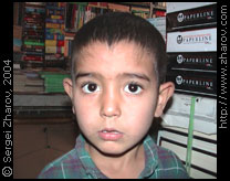
|
| A son of a bookstore owner, Kabul |
A. Fitzherbert, C. Mishra, Wakhan Mission Technical Report — Geneva: United Nations Environment Programme, 2003. — 104 p.(internet, 3.72 MB)
A great text on travels in Wakhan. Excellent photos, good maps, tons of useful information. Even humanitarian workers can be human sometimes. Adobe Acrobat format.
S. Sakaria, Concise English-Afghan Dari Dictionary — Kabul, 2002.
A pirated copy of an English–Dari dictionary. A short grammar section and enough words to get you around the whole country. It is sold in Kabul on Flower Street. Recommended.
Nick Danziger, Danziger's Travels: Beyond Forbidden Frontiers — Flamingo, 1993. — 448 p., ISBN 0586087060 (Amazon)
The book raises mixed feelings: it is interesting, but the author is an unpleasant jerk, and your money will go to his pocket if you buy the book. At the age of 26, in 1984, Danziger got a grant to travel along the Silk Route. Which at that time was practically impossible since it went through Iran, Afghanistan, and from Pakistan to China. The first two countries, naturally, did not issue tourist visas, and you could not get from the third one to the forth one. Still, he has managed to do it all, including illegal transit through Herat and Kandahar. The idea and the actual journey are appealing, but editors have asked Danziger to write about his feelings, too, and his shallow personality really spoils all the fun. I would recommend borrowing this book from a library or a friend, but financing Danziger with your money — no, avoid that.
Books on the Taliban
After 9/11 scores of writers rushed to putting new covers on their previously unpopular books on the Taliban.
Peter Marsden, The Taliban: War and Religion in Afghanistan — Zed Books Ltd, 2002. — ISBN 1842771671 (Amazon)
The author is not a journalist, and this is an objective and well written book. Recommended.
Ahmed Rashid, Taliban: Islam, Oil and the New Great Game in Central Asia — I. B. Tauris, 2000. — ISBN 1860644171
Ahmed Rashid, Taliban: Militant Islam, Oil & Fundamentalism in Central Asia — London, Yale University Press, 2001. — 279 p., ISBN 0300089023
It is the same book. Yellow journalism and gossip-mongering. Naturally, the most popular book on the Taliban at Amazon.com. Do not waste your money on it.
Mark Duffield, Patricia Gossman, Nicholas Leader, Review of the Strategic Framework for Afghanistan — Islamabad, AREU, 2001
I first thought the only relation this document had to Afghanistan was that its authors were heavily stoned on Afghan hashish in the process of writing. This is an insider report written by UN/NGO people for UN/NGO people right before the fall of the Taliban. It discusses why nothing works with humanitarian help in Afghanistan. But in the process we learn how it works. How the UN used humanitarian aid for political blackmail of the Taliban, how the UN strong armed NGOs, how the UN spied on the Taliban and NGOs, how the Taliban spied on the UN and NGOs, and how NGOs got it in the ass from just about anybody.
Books on Islam
Muhammad Taqi-ud-Din Al-Hilali, Muhammad Muhsin Khan. Interpretation of the meanings of the Noble Qur'an in the English Language. A summarized version of At-Tabari, Al-Qurtubi and Ibn Kathir with comments from Sahih Al-Bukhari — Riyadh: DARUSSALAM Publishers and Distributors, 1996. — 1311 p., ISBN 996074079X
It is useful to get familiar with Koran, especially through an edition that has meaningful comments accompanying the main text. This edition is the only one in English I could find, but naturally there are many more available.
The Summary of Sahih Boukhary, Volumes 1&2 — Beirut: Dar El Fikr, 1998. — 596 p., 544 p.
In the end of the 9th century a certain Muhammed Bin Ismail Al-Boukhari has collected and classified all available eyewitness accounts of Muhammed. This collection is called Hadith and is the second most important book after Koran in Islam. The stories are quite interesting. This particular edition has been bought in Damascus, in a bookstore across the road of Baramke bus station. Many more editions are available, naturally.
Jonathan Bloom, Sheila Blair, Islam: A Thousand Years of Faith and Power — London: Yale University Press, 2002. — 268 p., ISBN 0300094221 (Amazon)
Unbiased, well written, easy to read, covers the main ideas and early history of Islam. Recommended.
next: Index
more: Other things
this page: http://www.zharov.com/afghan/references.html
copyright: © Sergei Zharov, text, photos, maps, design, code, 2004–2024
feedback: sergei@zharov.com